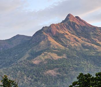
At 2,640 metres, Meesapulimala is the second-highest peak in South India, and the tallest that ordinary trekkers can actually climb without restricted-area permits. That distinction matters more than it sounds. Anamudi, its slightly taller neighbor, sits inside Eravikulam National Park and requires permissions that most travelers never bother to secure. Meesapulimala asks for nothing more than good boots and a willingness to keep walking uphill.
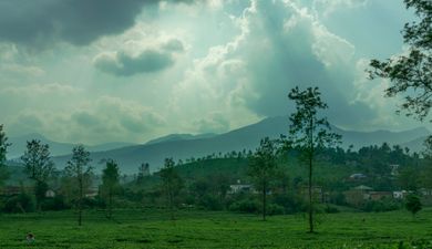
The name translates roughly to "hill of the whiskered leopard," after the caracals that once moved through these grasslands. You won't see one today — they've retreated deeper into the Ghats — but the landscape they left behind remains elemental and undomesticated. The peak rises from Munnar's tea country like a different continent altogether, its summit rolling with montane grasslands that feel more Scottish Highlands than South Indian hill station. This is the trek that quietly dismantles your assumptions about what Kerala can be.
A Trek That Earns Its Silence
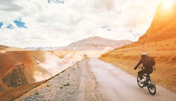
The standard route starts at Rhodo Valley, a forest department outpost roughly 25 kilometres east of Munnar town. From there, the trail stretches about 12 kilometres one way, climbing through a succession of eight peaks locally called "meesapuli hills" before reaching the summit. The total elevation gain is manageable — around 800 metres — but don't confuse moderate with casual. The path runs exposed along The Ridge, weather pivots without warning, and the final approach demands sure footing on loose rock and tussock grass that gives way under a careless step.
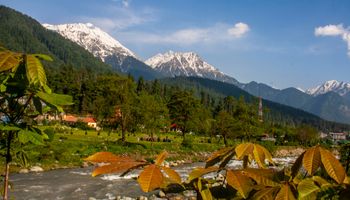
What catches you first isn't the exertion. It's the silence. Once you clear the first hill, the last trace of road noise dies completely. Shola forests crowd the valleys between peaks — dense, stunted, ancient — while the ridgeline stays bare and wind-scoured. You walk through alternating worlds. Dark canopy. Open sky. Dark canopy again.
The grass here, known locally as "pulimala grass," grows in thick clumps that turn gold-brown in the dry months and electric green after the monsoons. Between September and November, when the rains have recently passed, the entire hillside seems to glow from underneath. This is the window most experienced trekkers aim for. They're right.
What Actually Waits at the Top
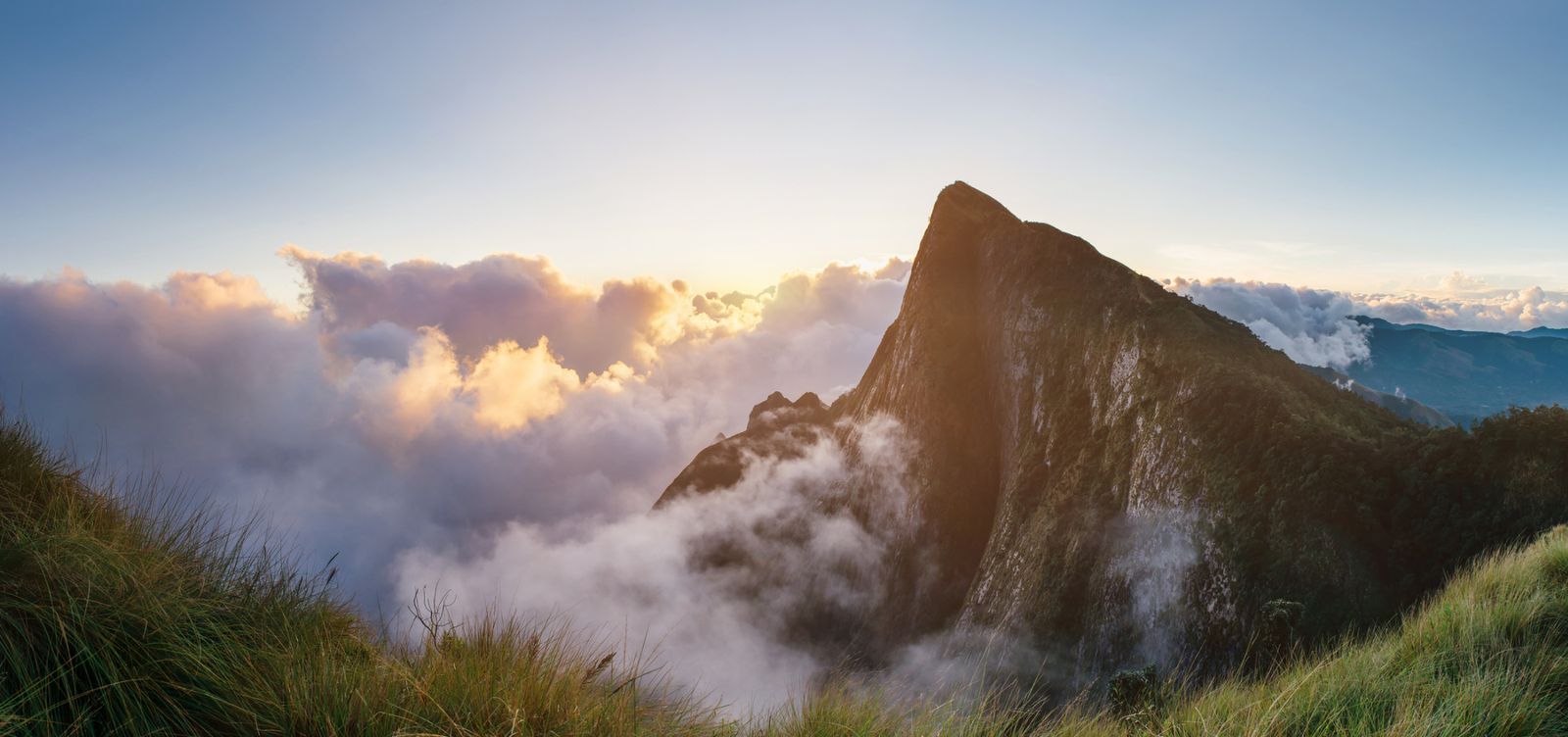
There's no dramatic rock spire. The summit is a broad, rounded plateau — almost disappointingly gentle after the approach — covered in the same windswept grassland that defines the entire ridge. A small cairn of stacked stones marks the highest point. That's it.
But the view earns forgiveness for any lack of vertical theater. On a clear morning, you can see the tea estates of Munnar spreading south and west like a green quilt thrown over crumpled bedsheets. To the east, the land drops steeply toward Tamil Nadu's rain shadow, and the color shift from wet-side green to dry-side ochre is visible in a single slow turn of the head. The Anaimudi massif dominates the northwest horizon. Below, the Kunthi River valley cuts a deep groove through the forest.
Here's the thing nobody tells you: the summit is often warmer than the trail. The valleys between the eight peaks channel wind into vicious corridors, but the broad top disperses it. Trekkers who've layered up for the climb frequently strip jackets at the peak. Carry your layers, but carry them loosely.
The Forest Department Holds the Keys
You cannot trek Meesapulimala without prior permission from the Kerala Forest Department. Permits are issued at the Munnar Wildlife Division office, and a licensed guide is mandatory — no exceptions, no negotiation. This isn't bureaucratic posturing. The grasslands are classified as part of the Kurinjimala Sanctuary, and the department limits daily trekker numbers to prevent trail erosion on the fragile montane soil.
Expect to pay around 1,500 to 2,000 rupees per person for the permit and guide combination, though fees shift periodically. The guide assigned to your group will typically come from a local tribal community, and their knowledge of the terrain is practical rather than rehearsed. They know where leeches concentrate after rain, which stream crossings hold, and how fast the clouds can seal off everything above 2,400 metres.
Most guided treks depart by 6 a.m. and return by late afternoon. An overnight camping option exists near the sixth peak, where flat ground and a nearby stream make a reasonable campsite. Camping permits require separate arrangements and cost more, but spending a night on that ridge — with no light pollution for a hundred kilometres in any direction — rewires something in your understanding of darkness. It's worth the paperwork.
When the Mountain Shuts the Door
Meesapulimala closes during peak monsoon, typically June through August, when trails turn to slick mud and visibility drops to a few metres. The forest department locks the route, and no amount of persuasion reopens it. Respect this. The grasslands sit on laterite soil that becomes genuinely treacherous in sustained rain, and evacuation from the upper ridges would challenge even experienced rescue teams.
The post-monsoon window from September to November delivers the greenest landscapes and moderate temperatures hovering around 10 to 15 degrees Celsius at the summit. December through February brings drier skies and sharper light, though early morning temperatures can dip below 5 degrees. March onward turns the grass golden and the air hazy — which carries its own austere beauty but kills long-range visibility.
Getting to the Trailhead Without the Runaround
Munnar town is the staging point, roughly 130 kilometres from Kochi and accessible by state bus, private taxi, or the winding self-drive route through Adimali. From Munnar, the road to Rhodo Valley passes through some of the Kannan Devan Hills' most photogenic tea plantations — a slow, narrow drive that takes about an hour by jeep.
No public buses run directly to Rhodo Valley. Your guide or a pre-arranged jeep handles the last stretch. If you're arriving in Munnar the night before — and you should, since a 6 a.m. departure means a 4:30 a.m. alarm — the town has plenty of functional guesthouses along the Mattupetty Road corridor. Skip anything that calls itself a resort. A clean room and an early breakfast are all you need before this kind of walk.
A Mountain That Doesn't Perform for You
Meesapulimala doesn't hand you its rewards at the entrance gate. There's no cable car, no selfie platform, no interpretive signage along the trail. The mountain asks you to walk twelve kilometres across an exposed ridge, and in return it reveals a version of South India that most travelers never suspect exists — high, cold, windswept, and profoundly empty. The whiskered leopards are gone. The silence they left behind is worth every step.