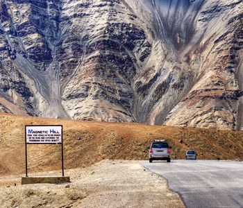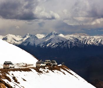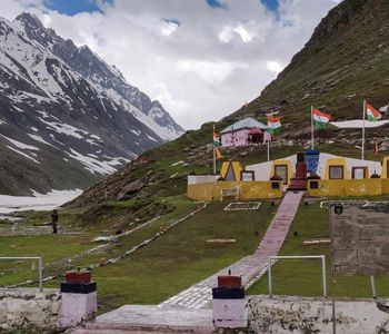
To reach Nubra Valley, you first have to cross Khardung La — a pass at roughly 17,582 feet above sea level, where the air thins until your lungs feel like they're pulling through a straw. The road switchbacks through snow-dusted rock, military convoys crawl past in the opposite direction, and prayer flags snap in wind that cuts through every layer you're wearing. Then the descent begins, and the landscape unfolds into something so improbable you wonder if altitude sickness has set in. Sand dunes. Bactrian camels. Green oases splitting a high-altitude desert. Nubra doesn't ease you in. It confronts you with contrast, and that's precisely why it stays with you long after Ladakh is behind you.
Where Two Rivers Carve a World Apart
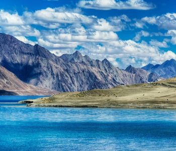
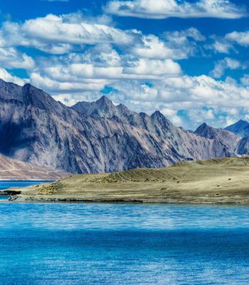
Nubra sits at the confluence of the Shyok and Siachen rivers, roughly 150 kilometers north of Leh. The valley floor rests at about 10,000 feet — a relative lowland by Ladakh standards — and your body will register the difference immediately after the pass. The air has substance again. You can breathe without thinking about breathing.
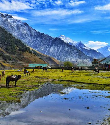
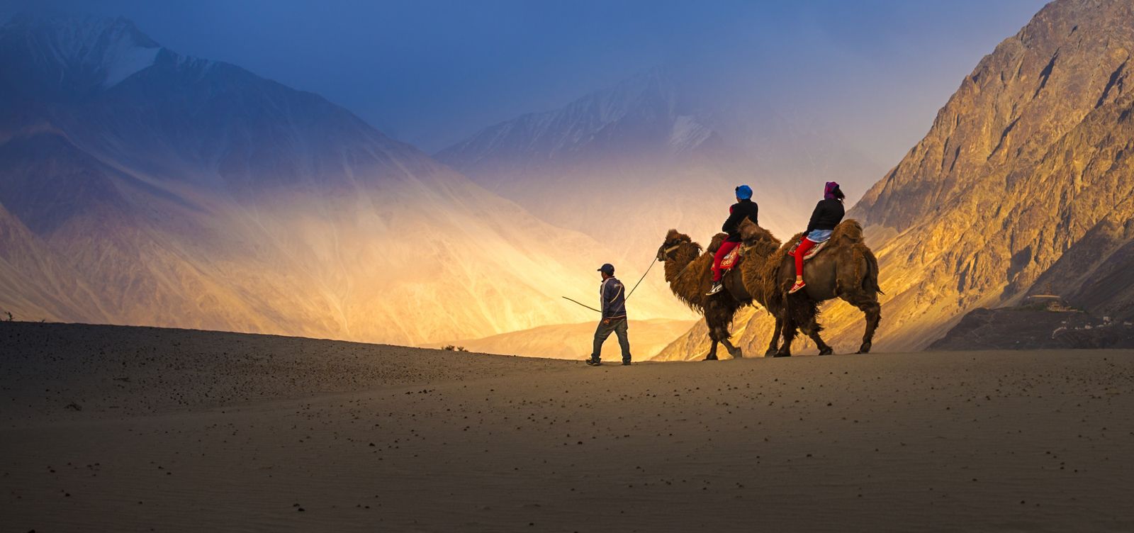
The geography here follows its own logic. Apricot orchards grow beside cold-desert dunes. Marmots dart between boulders while double-humped Bactrian camels — descendants of animals that once walked the Silk Road — plod across white sand at Hunder. Those camels are the photograph everyone comes for, and fair enough. A camel silhouetted against the Karakoram Range, with sand rippling underfoot at 10,000 feet, is genuinely disorienting. Your brain insists this can't be the Himalayas. But it is.
Sand Dunes at the Roof of the World
The dunes near Hunder village are Nubra's most photographed feature, and they earn it. Stretching along the Shyok riverbed, they formed over millennia as the river deposited fine sediment that wind sculpted into rolling mounds. They're not Saharan in scale — think modest, poetic ridges rather than towering crescents — but their existence at this altitude, flanked by jagged peaks dusted with snow, produces a landscape that feels borrowed from another planet.
Early morning is when the dunes belong to you. The light arrives low and amber, shadows stretch long across the sand, and the tourist camel rides haven't cranked into motion. By midday, the scene turns into a small carnival. If you want solitude with your sand, set an alarm.
Here's the thing about Nubra that nobody tells you in advance: its most famous feature is also its least representative. The dunes are spectacular, but they occupy a sliver of the landscape. The real texture of the valley lives in its villages, monasteries, and the enormous silence between them.
Monasteries at the Edge of Belief
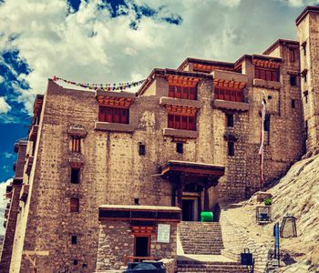
Diskit Monastery dominates the valley — literally. Perched on a hilltop above Diskit village, this 14th-century gompa belongs to the Gelugpa sect of Tibetan Buddhism. A 32-meter Maitreya Buddha statue, installed in 2010, faces down the Shyok Valley with an expression that manages to be both serene and watchful. Inside, murals crowd the walls in deep reds and golds, and the smell of yak-butter lamps hangs in every room like a permanent resident.
The climb up rewards you with a panoramic sweep of the valley floor — braided river channels, a patchwork of barley fields, the dunes dissolving into distance. Monks go about their routines with a studied indifference to visitors that feels refreshing rather than cold. You're welcome here. But this place doesn't exist for you.
Further north, Sumur village holds Samstanling Monastery, smaller and quieter, where you can sit in the courtyard and hear nothing but wind pushing through willow trees. The contrast with Diskit's relative bustle is sharp. If Diskit is the valley's public face, Samstanling is its private journal.
The Road to Panamik and the End of Civilian Ground
Most travelers stop at Hunder and Diskit. Those with time and an Inner Line Permit push further north to Panamik, where natural hot springs steam beside the road. The springs themselves are modest — stone-lined pools fed by geothermal water — but soaking in warm sulfurous water while staring at snow-capped peaks has a way of recalibrating your priorities. Your muscles unknot. The cold retreats. Everything simplifies.
Beyond Panamik, the road narrows toward the Siachen Glacier region, and civilian travel ends. The military presence thickens noticeably. Nubra has always been a frontier — it sat on the old trade route connecting Leh to Kashgar, and today it remains a strategically sensitive corridor. Army camps and checkpoints remind you that this landscape exists alongside geopolitical tension that hasn't relaxed in decades.
Sleeping Under a Sky That Won't Let You Sleep
Accommodation ranges from simple guesthouses in Diskit and Hunder to permanent tent camps along the riverbed. Choose the tents — not for luxury but for proximity. Canvas walls do little to block the cold after sunset, but they also do nothing to block the sky. At this altitude, with virtually no light pollution, the Milky Way doesn't appear. It detonates. Stars crowd so densely that familiar constellations become impossible to separate from the noise.
Bring a sleeping bag rated for freezing temperatures, even in summer. Nights drop sharply once the sun disappears behind the mountains. Guesthouses typically serve dal, rice, and chapati — honest food, nothing elaborate. A few places in Hunder now offer momos and thukpa with enough chili to warm you from the inside.
Getting There Without Losing Your Nerve
The standard route runs from Leh over Khardung La, a journey of roughly five to six hours by road. The pass is typically open from late May through October, though weather can close it without warning. Shared taxis and private vehicles are your primary options — there's no public bus service worth relying on. Indian nationals need an Inner Line Permit, obtainable online or through the DC office in Leh. Foreign nationals require the same permit and must travel in groups of at least two, with a registered travel agency handling the paperwork.
Spend at least one night acclimatizing in Leh before attempting the crossing. Altitude sickness is a real concern, not a suggestion on a pamphlet. Headaches, nausea, and breathlessness hit hardest on the pass itself, though most people recover once they descend into the valley.
When the Valley Shows Its Best Hand
June through September offers the warmest weather and most reliable road access. July and August bring occasional rain from distant monsoon systems, though Ladakh sits in a rain shadow and stays drier than most of the Indian Himalayas. September is arguably the finest month — the crowds thin, the light turns golden, and apricot trees begin to shift color. By late October, snowfall seals Khardung La and Nubra goes quiet until spring.
Nubra doesn't offer easy beauty. It asks you to endure a punishing mountain pass, navigate military checkpoints, and sleep in cold that finds its way through every blanket. What it returns is a landscape so geographically improbable that no photograph fully captures it. The sand beside the snow, the camels below the glaciers, the monastery bells echoing across a desert riverbed — Nubra operates entirely on contradictions. And those contradictions are exactly what make it impossible to forget.