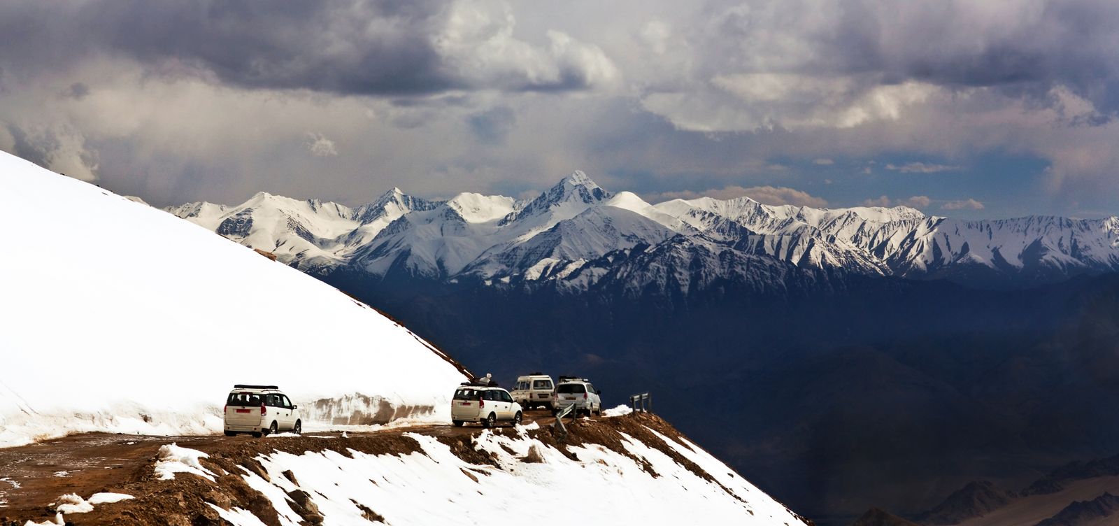
At roughly 17,582 feet, the air at Khardung La doesn't thin — it quits on you. Your lungs grope for something that's barely there. Thoughts arrive late, like messages sent through mud. The signboard at the top declares this the world's highest motorable pass, a claim cartographers and GPS surveys have been picking apart for years. But here's what matters more than the boast: whether or not Khardung La holds the official record, getting here remains one of the most physically punishing things you can do while sitting down. The pass links Leh to the Nubra Valley in Ladakh's far north, a route that once belonged to military convoys and pack animals. Now motorcyclists, truckers, and travelers in rented SUVs make the daily grind upward, all earning the same blunt reward — a barren, wind-flayed summit where prayer flags crack like gunshots against a sky so aggressively blue it looks computer-generated.
Built for War, Borrowed by Travelers
Khardung La exists because of conflict, not curiosity. The Indian Army's Border Roads Organisation — the BRO — carved and still maintains this pass as a supply line to the Siachen Glacier, one of the highest active battlefields on Earth. Every truck grinding up those switchbacks with rations and ammunition serves a garrison stationed in conditions that defy civilian imagination.
That military DNA explains everything about the road. It wasn't built for your comfort. Sections lurch between crumbling asphalt and raw gravel. During monsoon months, waterfalls pour straight across the roadbed, turning whole stretches into shin-deep rivers. BRO crews spend each summer patching what winter obliterates, and their hand-painted signs along the route have earned a cult following. "Be gentle on my curves," pleads one. "After whisky, driving risky," warns another. The humor runs dark, deadpan, and surprisingly practical — it keeps you alert on a road where a second's drift meets a thousand-foot drop.
What the Climb Actually Does to You
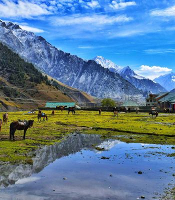
The ascent out of Leh starts easy. You drive north through the town's fraying edges, past army encampments and thin settlements, and the road begins lifting through wide switchbacks. Within thirty minutes, the world changes its mind about being habitable. Green irrigated fields yield to bare brown rock. Trees simply stop.
Around 14,000 feet, the first headache finds you. It comes quietly — a dull press behind the eyes, as though someone were slowly tightening a band around your skull. This is altitude asserting itself, and no gym membership overrides it. The road cinches tighter as you approach South Pullu, a checkpoint where soldiers examine your permits. Beyond this gate, the landscape goes lunar — grey scree slopes, stubborn patches of old snow even in July, and a silence so complete that wind and engine noise sound almost obscene.
The final kilometers to the summit coil through terrain that seems hostile to all biology. And here's the part nobody tells you: the descent toward Nubra Valley is harder than the climb. The north face holds more ice. The road surface falls apart. Your brakes — already warm from hauling you up — now bear the full, grinding burden of gravity. Most mechanical failures on this route happen heading down, not up.
The Summit and Its Ringing Silence
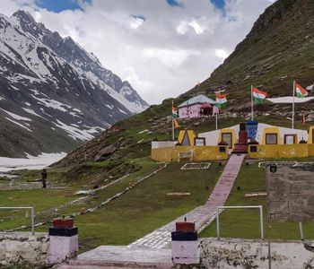
At the top, everything is contradiction. Prayer flags — so dense they form ragged walls — whip in ceaseless wind, their colors leached by ultraviolet into ghostly pastels. The famous signboard, painted blue and white, draws its ritual queue of travelers clutching phones. A small tea stall run by the army sells instant noodles and sweet chai. That chai, served in a steel cup that burns your fingers, may be the most altitude-abused cup of tea in India. It tastes extraordinary anyway.
Don't linger. That's not drama — it's medicine. At this elevation, the oxygen in your blood drops fast enough to notice. Twenty to thirty minutes at the summit gives you time to absorb the panorama — Karakoram peaks white with snow to the north, the brown-folded Ladakh Range spreading south — before your body starts filing formal complaints. Nausea and dizziness arrive quicker than you'd believe.
Permits, Timing, and the Mistake Almost Everyone Makes
Indian nationals need no special permit for Khardung La. Foreign travelers must obtain an Inner Line Permit through the District Commissioner's office in Leh or via registered travel agents. The process takes about a day; bring passport copies and photographs.
The pass generally opens from late May through October, though the BRO sometimes keeps it running into November depending on snowfall. June and September deliver the best conditions — dry roads, manageable traffic, clear skies. July and August carry monsoon moisture that rarely falls as rain at this altitude but generates fog thick enough to shrink visibility to a few car lengths.
Here's the mistake that fills Leh's medical clinics every summer: travelers schedule Khardung La for their first or second day after flying in. Don't. Leh sits at 11,500 feet, and your body needs a minimum of two full days acclimatizing at that elevation before you attempt the pass. Acute mountain sickness doesn't care how many marathons you've run — it strikes fit and unfit alike, without preference or apology. Spend those first days walking Leh's monastery trails, drinking water until you're sick of water, and sleeping as much as gravity allows.
The Practical Business of Getting Up There
The pass lies roughly 40 kilometers north of Leh, but the drive takes three to five hours depending on road conditions and traffic. Most travelers hire a local driver with a Toyota Innova or Mahindra SUV — both common, both built for exactly this kind of punishment. Renting a Royal Enfield motorcycle is the romantic choice, and thousands make it every summer, though only experienced riders should try. Altitude-dulled reflexes, loose gravel, and oncoming trucks leave no margin for hesitation.
Fill your tank in Leh. There are no petrol stations between town and the pass. Carry water, basic headache medication, and a proper jacket even in midsummer — temperatures at the summit hover near freezing no matter what the season is doing in the valley below.
What Lies on the Other Side
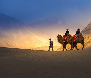
Khardung La is not a destination. It's a toll gate. Beyond it opens the Nubra Valley — surreal sand dunes at Hunder, double-humped Bactrian camels moving with improbable dignity, monasteries gripping cliffsides above the Shyok River. The pass earns its reputation not as a summit to conquer but as the price of entry to one of the most geographically unlikely valleys on the subcontinent. Pay it gladly. Breathe slowly. And let each labored step at the top remind you that some places matter precisely because they refuse to make it easy.